How to Find Free Campsites in the USA
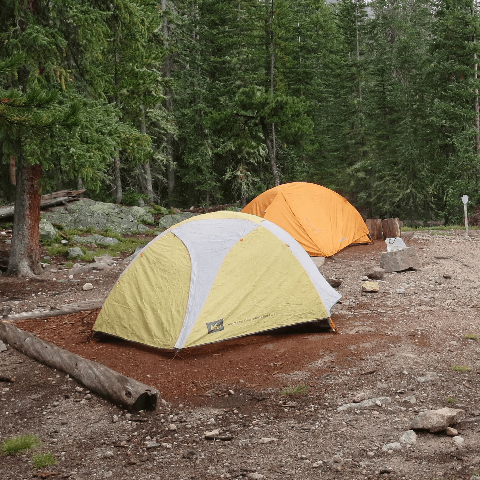
Photo by [NPS](https://home.nps.gov). Public domain.
How to Find Free Campsites in the USA
We pulled off a forest road in southern Utah at sunset, tires crunching on packed dirt, and found a spot that looked like it had been placed there specifically for us. Red rock walls on three sides, a cottonwood tree providing shade, and not another human being in sight. No permit required. No reservation made three months in advance. No fee. That spot was public land, and it was ours for the night.
Finding free campsites in the USA is not some obscure skill reserved for hardcore overlanders. It's available to anyone willing to learn which land is public, how to read the maps, and which apps actually help versus which ones waste your time. We've spent two years doing this across 30 states and we're going to tell you exactly how.
Understanding Public Land (BLM, USFS, WMA)
The United States government owns about 28 percent of all land in the country. That's roughly 640 million acres of public land where you can camp for free, as long as you follow the rules. The three main types of land that matter for free camping are:
Bureau of Land Management (BLM) land. About 245 million acres, mostly in the western states. BLM land is the gold standard for free camping because it's vast, usually remote, and has the fewest restrictions. Most BLM land allows 14-day dispersed camping stays. Some areas have designated Long-Term Visitor Areas where you can stay up to seven months during the winter. BLM land is especially abundant in Arizona, Nevada, Utah, Wyoming, and Colorado.
United States Forest Service (USFS) land. About 188 million acres spread across National Forests in every state. Dispersed camping is allowed in most National Forests unless specifically posted otherwise. The rules are similar to BLM, typically 14 days per site. National Forests tend to be greener and more forested than BLM land, with more developed roads and sometimes even maintained campground facilities nearby.
Wildlife Management Areas (WMAs). These are state-managed lands that vary enormously in their camping policies. Some states allow free camping on WMA land. Others don't. Some require a hunting license to access them. Check the specific state's wildlife agency website before assuming you can camp on a WMA.
The other land types worth knowing about: National Wildlife Refuges (usually no camping), National Park Service land (camping usually costs money), and State Parks (fees apply, usually $15 to $35 per night). National Recreation Areas and National Seashores sometimes have free dispersed camping options.
Best Apps for Finding Free Campsites
After trying every camping app we could find, here are the ones that actually deliver value for finding free sites.
iOverlander. This is our number one tool. It's free, community-driven, and works offline once you download the data. Users pin locations with details about terrain type, cell service quality, noise level, road conditions to reach the site, and whether anyone has ever told them to leave. We check it every time we enter a new area. The app isn't pretty, but the data is real and current.
FreeRoam (freero.am). A web-based tool that overlays BLM and National Forest boundaries on a map, with user-submitted campsite locations. The interface is clean and the public land boundaries are accurate. This is the fastest way to visually identify where free camping is legal in any given area. We use it on a laptop during route planning and switch to iOverlander on the phone when we're actually looking for a spot.
Campendium. A solid resource with reviews of both paid campgrounds and free dispersed camping areas. The free camping listings are more limited than iOverlander but the reviews are detailed and well-written. Useful for comparing options in areas where multiple free campsites exist.
The Dyrt. The largest camping app in the US by number of listings. It includes both paid and free sites. The pro version ($35/year) lets you search specifically for free camping and shows offline maps. We use the free version and supplement with iOverlander for the most current free site data.
OnX Offroad. Specifically for overlanders and people who want to access public land via unpaved roads. It shows public land boundaries, trail conditions, and GPS tracks from other users. Worth the subscription if you regularly drive forest roads to reach your campsites.
How to Read Dispersed Camping Regulations
Calculate how much your route will actually cost
Try the Cost CalculatorFree · Based on 2026 real data · All 50 states
Free · 2026 data · All 50 states
This is the part that trips up most beginners. You can't just camp anywhere on public land. Here's how to figure out what's legal.
Start with the Motor Vehicle Use Map (MVUM). Every National Forest publishes an MVUM that shows which roads allow dispersed camping. These maps are free and available at forest service offices or online as PDFs. Roads marked as open to "all vehicles" typically allow dispersed camping along them. Roads marked "high clearance only" or "4WD only" still allow camping, but you need the right vehicle to reach them.
Check for posted restrictions. Some areas have seasonal closures for fire danger, wildlife protection, or watershed management. These are usually posted at the entrance to the area or on the forest website. A red "closed" sign means exactly what you think it means.
BLM Travel Management Plans. BLM land is managed at the field office level, and rules vary by area. Some BLM land is open for dispersed camping everywhere. Some has designated camping areas only. Some requires a permit. Call the local BLM field office if you're unsure. Their number is on the BLM website.
Distance requirements. Most public land requires you to camp at least 100 to 200 feet from water sources and at least a certain distance from roads (varies, but 300 feet is common in many National Forests). These rules protect water quality and wildlife habitat. They're also how you avoid the awkward experience of being woken up by a ranger who points out you're parked in a restoration area.
Stay limits. The standard limit is 14 days within a 28-day period on both BLM and National Forest land. After 14 days, you must move to a different site, usually at least 25 miles away in some BLM jurisdictions. Some areas have shorter limits during peak season. Some Long-Term Visitor Areas have different rules (longer limits during winter months).
Free Camping vs Paid Campgrounds: Pros & Cons
Sometimes a paid campground is the right choice. Here's an honest comparison so you can decide based on the situation.
| Free Camping (Dispersed) | Paid Campground | |
|---|---|---|
| Cost | $0 | $15 to $50/night |
| Hookups | None | Water, electric, sometimes sewer |
| Bathrooms | None (bring your own solution) | Flush toilets, sometimes showers |
| Cell service | Often limited or none | Usually better (campgrounds at lower elevations) |
| Site quality | Variable, can be amazing | Consistent, sometimes crowded |
| Reservations | Never required (first come, first served) | Often required, especially in summer |
| Privacy | Usually excellent | Varies, can be shoulder-to-shoulder |
| Safety | Remote, self-reliant | Staff on-site, neighbors nearby |
| Best for | Extended stays, solitude, budget travel | Bad weather, need for showers, families |
The honest truth is that we mix both. About 70 percent of our nights are free camping. The other 30 percent are paid campgrounds where we fill our water tanks, charge the battery from shore power, use a real shower, and reset. It's a sustainable rhythm that keeps costs low without making us feel deprived.
If you're in the Southeast and want to mix free and paid options, North Carolina has excellent National Forest dispersed camping plus affordable state park campgrounds that give you the best of both. In the Southwest, Patagonia Lake State Park is a great paid basecamp at $20/night while you explore the free BLM camping in the surrounding area. And if you're in Texas, the free dispersed camping on surrounding ranchland near Enchanted Rock pairs well with the park's own budget-friendly $10-per-person camping for days when you want a bit more comfort.
Strategies for Finding Great Free Sites
Anyone can download an app and follow pins to established campsites. But the real skill is finding sites that aren't on any app. Here's how we do it.
Drive the forest roads slowly. When you enter a new National Forest or BLM area, drive the main roads first at 15 to 20 mph. Look for pull-offs that are wide enough for your van, have a flat surface, and show signs of previous use (fire rings, cleared areas). The best sites aren't always the first ones you see. We've driven past three mediocre spots to find a great one half a mile further in.
Ask the locals. Ranger station staff know the area better than any app. We've had rangers point us to incredible free sites that weren't listed anywhere online. The key is to ask respectfully. Walk in, introduce yourself, and say something like "We're looking for a quiet spot for a night or two, anywhere you'd recommend that's not too sensitive." They'll often tell you exactly where to go. Gas station attendants, local farmers, and diner owners can also point you in the right direction.
Use satellite imagery. Google Earth and the onX app let you view public land boundaries overlaid on satellite imagery. You can spot clearings, fire roads, and potential campsites from your phone before you even drive there. We've planned entire trips by studying satellite imagery of the public land along our route, then confirming the sites when we arrived.
Follow other van lifers and overlanders. Instagram and YouTube van life content creators often share specific GPS coordinates for their favorite free campsites. Take these with a grain of salt because popular sites can get crowded, but they give you a starting point for an area you've never visited.
Check county and municipal land. Some counties and cities own land that allows free camping. This is especially true in the West where county parks sometimes have no-fee camping options. These are rarely listed on the major camping apps but may appear on county websites or through local tourism offices.
Seasonal Considerations for Free Camping
Free camping availability shifts with the seasons, and not just because of weather.
Spring (March through May) brings wildflower season in the desert Southwest and the beginning of fire restrictions in many areas. Desert boondocking is peak season during spring. Snowmelt can make forest roads impassable at higher elevations. Check road conditions before driving into the mountains.
Summer (June through August) is when dispersed camping is most accessible across the northern states and higher elevations. But it's also when fire restrictions are most likely to close areas. In the Southwest and California, fire danger can shut down entire forests to dispersed camping by July. Always check fire restrictions before heading out. Have a backup plan.
Fall (September through November) is our favorite season for free camping. The bugs are dying off, the crowds are gone, the temperatures are comfortable, and the fall colors in places like the Ozarks, the Appalachians, and the northern forests are spectacular. This is when we do our longest stretches of boondocking.
Winter (December through February) pushes most van lifers south. Arizona, southern California, Texas, and southern Florida all have active boondocking communities in winter. The Arizona Long-Term Visitor Areas are the epicenter, with thousands of van lifers camping for free from September through April. Cold weather camping is possible in northern forests but requires serious preparation for heating, water, and battery management.
Free Camping Etiquette That Keeps Sites Open
This matters more than most people realize. Every time a dispersed camping area gets trashed, land managers face pressure to close it. We've seen popular free camping areas shut down because of human waste left on the ground, fire rings built in the wrong spots, and people cutting live trees for firewood. Here's how to be the kind of camper that keeps these areas open for everyone.
Camp on established sites whenever they exist. If you can see a fire ring or a flattened area where previous campers parked, use that spot. Creating new sites damages vegetation and fragments the landscape. One of the Leave No Trace principles is to "travel and camp on durable surfaces," and that means using the spots that are already impacted rather than creating new ones.
Keep your campsite small. Don't clear vegetation for a bigger parking area. Don't drive off the road to find a "better" spot that creates new tire ruts on fragile desert soil. In the desert Southwest, cryptobiotic soil crusts take decades to form and one tire track can destroy them for years. Stay on established roads and existing pull-offs.
Fire safety is non-negotiable. Use existing fire rings only. Keep fires small and manageable. Have water nearby to extinguish completely before leaving or sleeping. In fire-prone areas, skip the campfire entirely and use a camp stove for atmosphere. Many dispersed camping fires start because people didn't fully extinguish their campfire. Be the person who doesn't contribute to that statistic.
Noise and light discipline matters in remote areas. Sound travels far in open country. If you're running a generator, point it away from other campsites and use it only during daytime hours. Run lights pointed down, not up. We've been annoyed by neighbors running bright flood lights at midnight in areas where the natural darkness was the whole point of being there. Also worth noting: each state has different dispersed camping rules on public land.
FAQ
Is dispersed camping legal everywhere on public land?
No. Dispersed camping is allowed on most BLM and National Forest land, but specific areas may be closed for fire danger, wildlife protection, or resource management. Always check the local Motor Vehicle Use Map and any posted restrictions before setting up camp. Some areas require permits or have designated sites only.
Can I camp for free at National Parks?
Generally no. National Parks charge fees for camping, usually $20 to $35 per night at established campgrounds. However, the National Forests that surround most National Parks allow free dispersed camping. You can camp for free in the forest and drive into the park for day visits. This is exactly what most budget-conscious visitors do.
How do I find cell service at free campsites?
Check iOverlander reviews for cell service reports from other users. Coverage maps from your carrier give a general idea but aren't always accurate in remote areas. We carry SIM cards from both Verizon and AT&T to maximize coverage options. For truly remote camping, a satellite communicator like a Garmin inReach is worth the investment.
What do I do about waste when free camping?
Human waste must be buried in a cathole 6 to 8 inches deep, at least 200 feet from water sources. Toilet paper should be packed out in a sealed bag. Gray water (dishwater, shower runoff) should be strained and scattered broadly over a large area, not dumped in one spot. Pack out all trash. Leave the site cleaner than you found it and the land stays open for everyone.
Plan Your Van Life Budget
Use our free calculator to estimate van life costs by state, based on real 2026 data.
Try the Cost Calculator